Karhutla IKN — Wind, Smoke & Wildfire Visualization
Interactive map of wind flow and PM2.5 smoke over the IKN region, with hour-by-hour back-tracking of where the smoke came from.
- Role
- Frontend & Geospatial Developer
- Year
- 2026
- Technologies
- JavaScriptLeafletHTMLPython
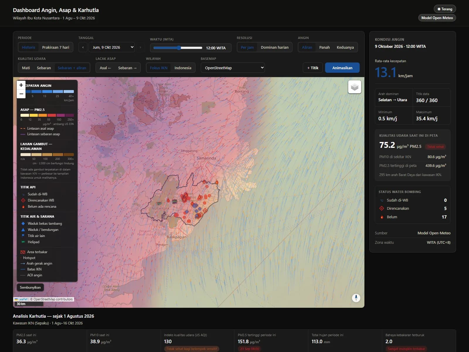
Overview
A backend-free static web app that visualizes wind and air quality over Indonesia's new capital (IKN) and traces where and when the smoke at a point came from.
The Problem
Wildfire analysis needs an easy-to-read picture of wind and smoke, not just number tables from several data sources.
Approach
ERA5 reanalysis and Open-Meteo forecast wind, plus CAMS PM2.5/PM10, are pulled straight from the APIs with nothing simulated. Windy-style streamline particles are rendered on Leaflet, with bilinear interpolation only between real data points.
Challenges
During testing the unpkg CDN was unreachable, so the map failed and the page took 21 seconds to load. Leaflet was vendored locally — load time dropped to 0.08 seconds.
Solution
A 360-point Indonesia-wide wind grid, 7-day forecast, wind-driven smoke layer, forward/backward trajectory tracing, peatland overlay (PP 71/2014), wind rose, Ångström fire-danger index, 7 basemaps, and dark mode.
Results
Runs entirely in the browser with no API key, and is publicly deployed on Vercel.